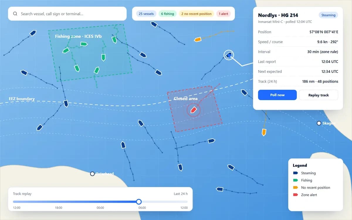
Tracking
Vessel Monitoring (VMS)
Collect, validate and display vessel positions from every terminal type.
- Inmarsat Mini-C
- Iridium SBD
- LTE trackers
- Polling & intervals


Tracking & Compliance
Mobilware's VMS platform handles regulatory vessel tracking for fisheries authorities in Denmark, Sweden, the Faroe Islands, Germany, Greenland, Morocco and beyond. It collects positions from Inmarsat Mini-C terminals and Iridium SBD trackers, processes fisheries reports, and delivers validated data to national systems through standard interfaces such as FLUX, UVMS and Visma (Twoday).
Proven in national programmes
In daily use for fisheries monitoring in Denmark, Sweden, the Faroe Islands, Germany, Greenland, Morocco and more.
Every terminal, one platform
Inmarsat Mini-C, Iridium SBD trackers and LTE devices reporting into the same environment.
Standards-based exchange
FLUX, UVMS and Visma (Twoday) integrations deliver data in the formats authorities already use.
Fewer gaps, faster follow-up
Missing reports, terminal faults and zone events are flagged automatically for action.










The platform
Eight connected modules, from the terminal on board to national and international data exchange.
Tracking
Collect, validate and display vessel positions from every terminal type.
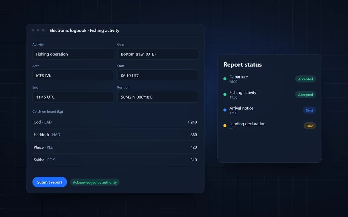
Reporting
Process electronic logbook and fishing activity reports alongside position data.
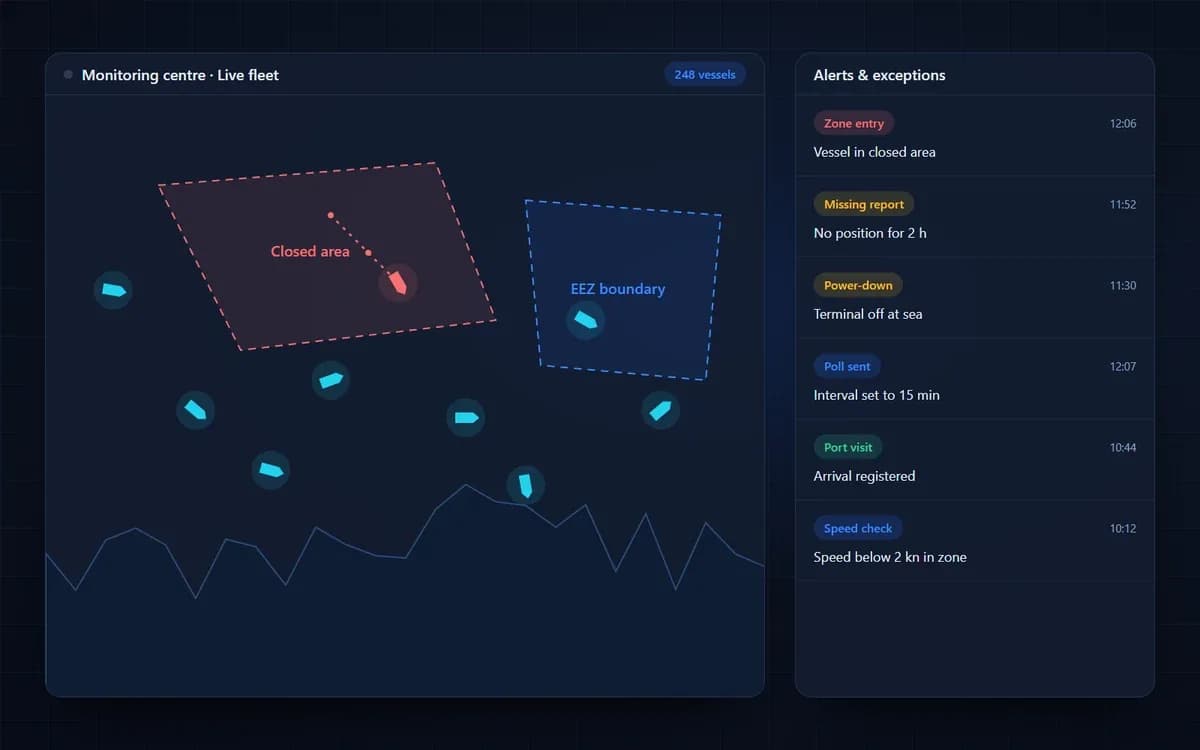
Monitoring
Give monitoring centres one view of fleet activity, events and exceptions.
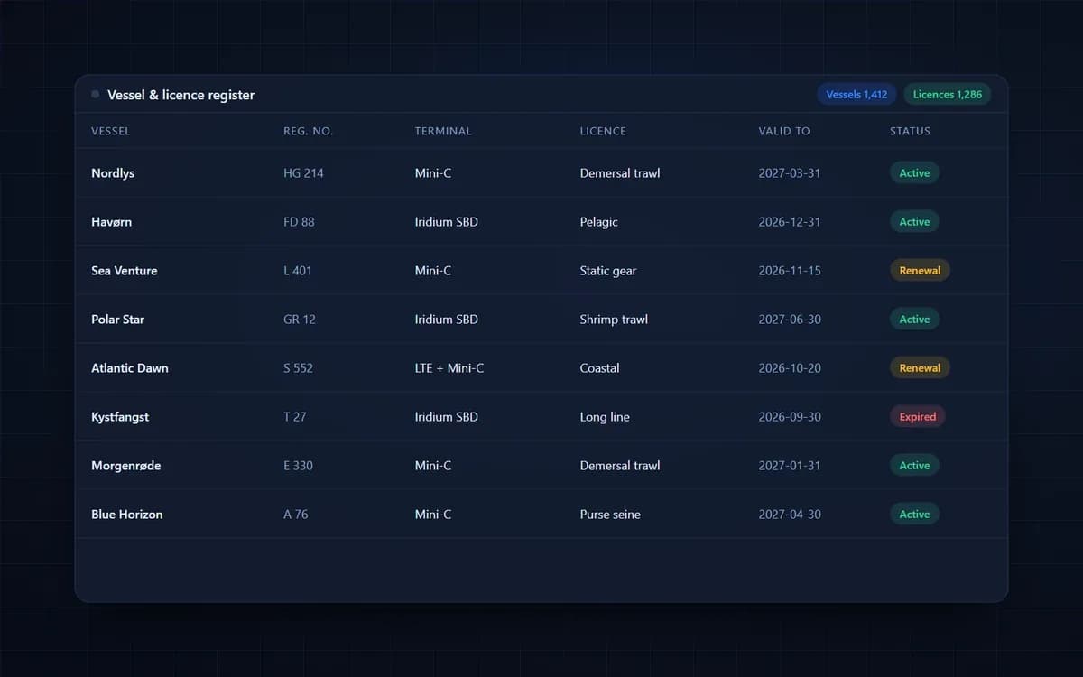
Governance
Keep vessels, owners, terminals and licences in one register with full history.
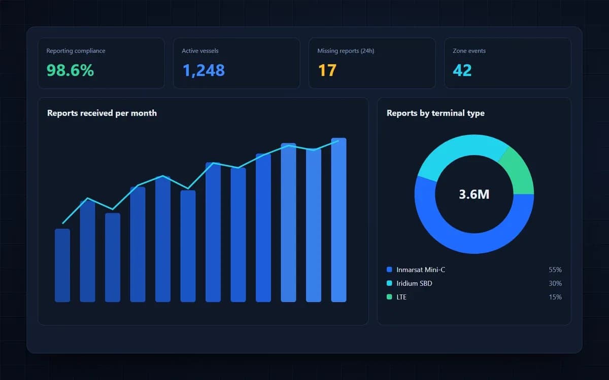
Intelligence
Turn monitoring data into compliance statistics, dashboards and audit-ready reports.
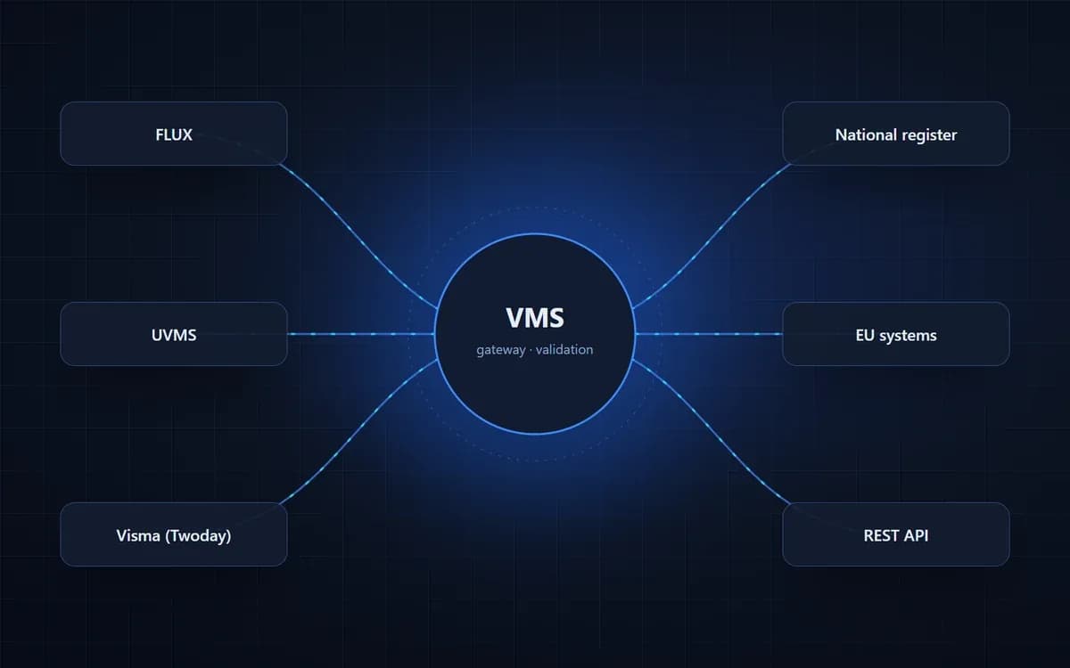
Interoperability
Exchange fisheries data securely with national, regional and EU systems.
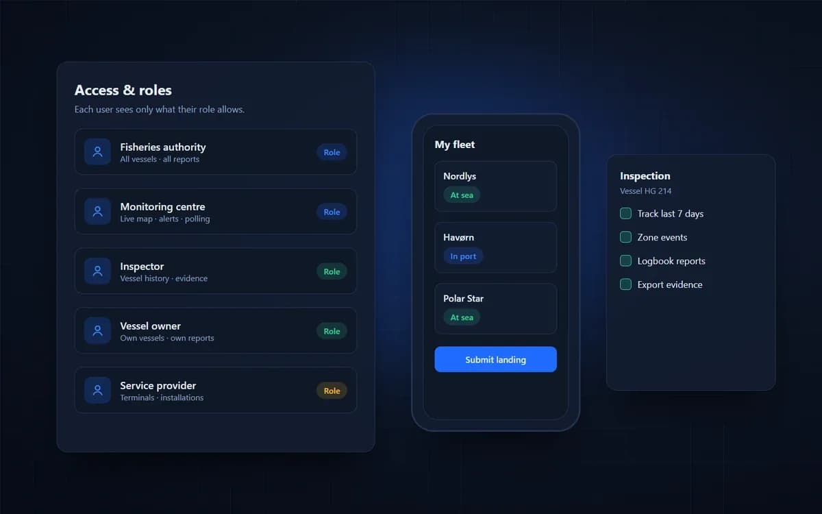
Field operations
Role-based access for vessel owners, service providers and inspectors.
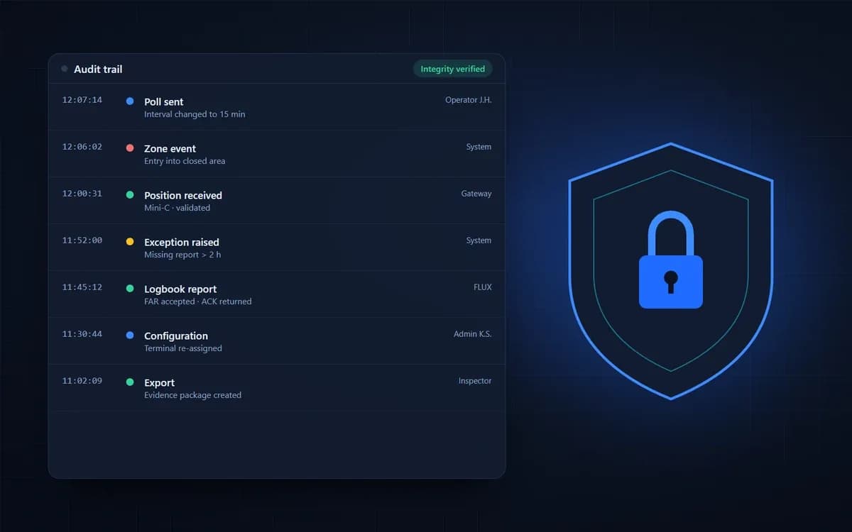
Assurance
Legally robust data with a complete trail of every report, poll and change.
Capabilities
Everything a fisheries monitoring centre needs, from the terminal on board to the national data exchange.
Scheduled and on-demand position, speed and course reports from satellite and cellular terminals.
Poll terminals and change reporting intervals remotely, for example when vessels enter closed or sensitive areas.
Vessels, owners, terminals, licences and permits kept in one register, with full change history.
Transport and processing of electronic logbook and fishing activity reports, with acknowledgements where supported.
EEZs, closed areas, ports and custom zones, with entry and exit events and port-visit detection.
Missing reports, power-down, terminal tampering, speed or zone violations, routed to the right operator.
FLUX, UVMS and Visma (Twoday) interfaces, plus REST APIs and file-based exchange for national systems.
Live map, vessel history and track replay, report inspection and case notes for MCS teams.
Role-based access for authorities, service providers, vessel owners and inspectors.
Fleet activity, effort, reporting compliance and data-quality statistics, exportable for audits.
Every report, poll and configuration change is logged and traceable for legal and evidential use.
Terminal installation guidance, onboarding of fleets and 24/7 operational support.
In detail
Our VMS has grown with the authorities that use it. These are the building blocks behind every national deployment.

The long-established global standard for regulatory VMS.
Truly global coverage, including the polar waters around Greenland.
Electronic logbook and activity reports alongside position data.
Integrated with the major fisheries data-exchange standards.
Tools that support inspection and the fight against IUU fishing.
Reliable data that holds up in audits and enforcement.
How it works
The vessel terminal sends positions, and the e-logbook sends fishing activity reports.
Data travels over Inmarsat Mini-C, Iridium SBD or LTE, depending on terminal and coverage.
The platform decodes, validates and enriches each report, and matches it to the right vessel and licence.
Monitoring-centre staff see live positions, zone events and exceptions, and can poll vessels on demand.
Data reaches national and international systems through FLUX, UVMS, Visma (Twoday) or APIs, with acknowledgements returned where supported.
VMS data flow. Vessel: Terminal / e-logbook → Transport: Satellite, LTE → Gateway: Gateway → Authority: Authority VMS, E-log system
From the Baltic to the Arctic waters around Greenland and the Atlantic coast of Morocco, our VMS supports authorities that need dependable, legally robust vessel monitoring. Each deployment reflects local regulation, terminal fleets and national systems, while sharing one proven platform. That experience means faster rollouts, fewer surprises and a partner who understands both the technology on board and the processes in the monitoring centre.
Fisheries monitoring rarely runs on a single technology. Fleets mix Inmarsat Mini-C terminals, Iridium SBD trackers and near-shore LTE devices, while authorities must exchange data with national registers, EU systems and neighbouring states. Our VMS brings it all together: one gateway for every terminal type, one view of every vessel, and standard interfaces such as FLUX, UVMS and Visma (Twoday) for clean, timely data exchange.
Beyond tracking, the platform helps authorities capture reports correctly the first time, check them against each other, keep data quality high and turn it all into decisions.
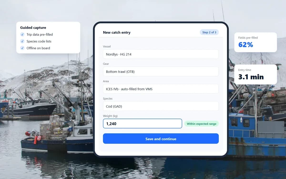
Data capture
Faster, more consistent reporting on board and at the quay, with less manual typing.
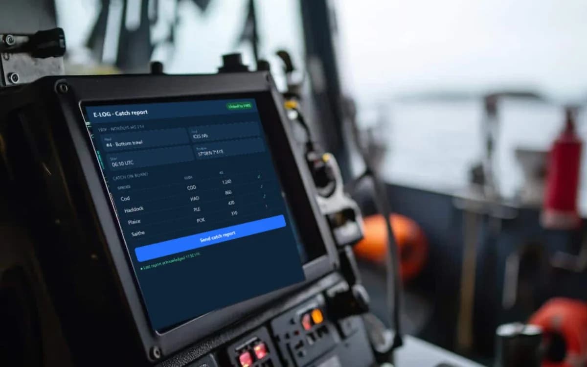
Validation
Cross-check logbook, landing and sales figures automatically for every trip.
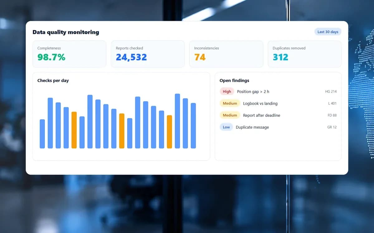
Data quality
Detect missing, late, duplicate or inconsistent reports across all connected sources.
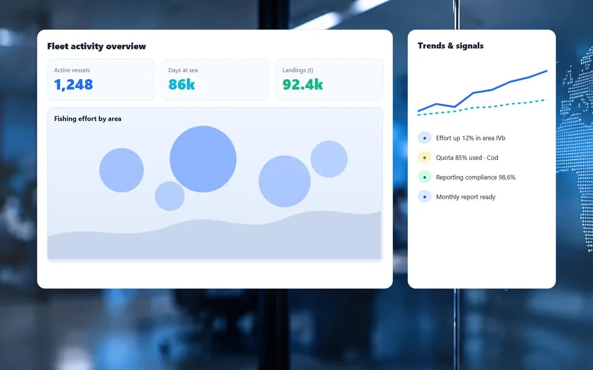
Decision support
Give fisheries managers, analysts and inspectors a clear view of activity and trends.
Operations
From fleet dashboard to the complete life of a single report. Select a view, then click the screenshot to see it at full resolution.
Operations
Live vessel positions on the map with fishing zones and restricted areas, fleet status, Iridium message volumes, latest events, system health and recent e-log submissions in one view.
Screen 1 of 4
Support is subject to device-specific integrations and certification. Not every terminal supports every e-logbook workflow.
Inmarsat Mini-C
Position reporting, polling and interval control
Iridium SBD trackers
Position reporting and two-way commands
Iridium Certus
IP-based reporting
Mobilware LTE trackers
Near-shore cellular reporting
Discuss national VMS and e-reporting infrastructure, endpoints and rollout.
Speak to a specialistAdd VMS services for your fleet customers on supported terminals.
Request a technical briefFAQ
Inmarsat Mini-C, Iridium SBD, Iridium Certus and Mobilware-developed LTE tracking devices, subject to device-specific integrations and certification.
Where the terminal and authority workflow support it, acknowledgements are returned from the authority system through the gateway to the vessel.
Yes — the gateway abstracts transport so satellite and cellular reports from the same fleet are handled in one environment.
Fisheries authorities and fleets in Denmark, Sweden, the Faroe Islands, Germany, Greenland and Morocco, among other countries, use our VMS for regulatory vessel monitoring.
FLUX, UVMS and Visma (Twoday) integrations are in production, alongside REST APIs and agreed file formats for national and regional systems.
Yes. Monitoring-centre staff can poll vessels and change reporting intervals on supported terminals, for example when a vessel enters a closed area.
The platform tracks expected reporting for every vessel. Missing reports, power-down and terminal faults raise alerts so operators can follow up quickly.
Every report, poll and configuration change is logged with time stamps and source, giving an audit trail that supports inspections and legal follow-up.
Mobilware's tracking environment is designed to receive, normalize and manage telemetry from a broad range of tracking protocols, including satellite and cellular device formats.
Learn moreNational monitoring • Global interoperability • Multi-ASP integration.
Learn moreFrom compact LTE tracking devices to satellite tracking terminals and purpose-built accessories, Mobilware's in-house engineering capabilities help turn demanding connectivity requirements into integrated hardware and software solutions..
Learn moreTell us what you need to connect, automate or monitor. Our team can help define a practical architecture — from a single integration to an end-to-end environment.